Geoconservation is the preservation of the geological heritage and history (evolution) of the earth. In order for this to happen, geoparks must work in partnership with the local population, public and private institutions, and specialized agencies. Geoconservation is directly related to society's understanding of its real scientific, educational, and historical-cultural importance.
One of the major concerns of geoparks is related to the policies and measures necessary to guarantee the total integrity of fossils, as well as safeguarding the landscape heritage and geodiversity, which consists of the variety of geological environments, phenomena, and active processes that give rise to landscapes, rocks, minerals, fossils, soils, and other surface deposits that support life on Earth (Gray, 2004), notably in the areas of Paleontological Sites.
In this sense, the various localities with proven paleontological potential within the municipality of Uberaba, especially in the vicinity of Peirópolis, are protected by state and municipal legislation as well as by actions aimed at valuing the Geological Heritage.
Environmental Protection Area (APA) Rio Uberaba
The Peirópolis Paleontological Site and other contiguous fossiliferous localities are within the indirect influence area of the APA - RU, a conservation unit created by State Law No. 13.183 of January 21, 1999 (Published in the Minas Gerais Executive Diary - 01/21/1999 page 13 col. 2 microfilm 572). The creation text of the APA contemplates reports about 51 of the lithostratigraphic units outcropping in the entire direct and indirect influence area of the conservation unit, as well as a broad description of the fossil groups discovered in these localities, in addition to the history of the actions developed by the CPPLIP and Dinosaur Museum regarding research, teaching, dissemination, and popularization of the science of fossils, and measures for the preservation of the paleontological heritage.
Peirópolis Natural Monument - Municipal Law No. 10.339
Municipal Law No. 10.339, published in the Porta Voz newspaper on March 29, 2009, officially transformed the Peirópolis Special Protection Area (APE) into the Peirópolis Natural Monument (MNP) (Figure 27). This guideline is in line with the National System of Conservation Units Law - SNUC - Federal Law No. 9,985 / 00, effectively guaranteeing the protection of the areas surrounding Peirópolis, where one of Brazil's main paleontological sites is located. It prohibits any developments within its perimeter that jeopardize the integrity of fossil records, categorically prohibits any activities other than paleontological research, teaching, dissemination, and tourism, with the exception of agricultural and livestock activities already developed.
Source: https://www.researchgate.net/figure/Figura-28-Mapa-de-localizacao-da-area-do-monumento-natural-de-Peiropolis_fig11_313628869
Legislation (National and Municipal) regarding geoconservation
Considering the above, we observe that public policy actions aimed at laws on geoconservation ensure that humans comply with environmental rules. In Brazil, there is Decree Law n° 4.146 of March 1942, which regulates the protection of fossil deposits and states that they are properties of the nation (BRASIL, 1942).
Furthermore, this Decree also regulates the need for prior authorization from the National Mining Agency regarding fossil extraction (BRASIL, 1942). Thus, there is a federal norm that protects geological heritage.
In Uberaba, in 2015, while a condominium construction was taking place in the Vila Olímpica neighborhood, next to Praça Shopping, two dinosaur fossil skeletons were found.
At that time, the CCCP team contacted the National Mineral Agency, the Prosecutor of the Public Ministry of the State of Minas Gerais - Dr. Carlos Alberto Valera -, and the Secretary of the Municipal Environment. Together, they wrote a text, each with their respective expertise in the subject, to be sent to the Municipality of Uberaba for it to promulgate the Decree.
Thus, on July 17, 2015, the Municipality of Uberaba promulgated Portaria n°003, which establishes criteria and procedures for excavation, soil movement, or any other interference that may damage fossil reserves in the territory of the city of Uberaba (UBERABA adota..., 2015).
This action aligns with the definition of geoconservation and provides the municipality with laws that protect the geological heritage of the city, often serving as a model for other metropolises and geoparks.
According to the aforementioned Portaria, the person responsible for the construction must have authorization from a specialized technical professional, who must be a paleontologist or geologist, with proven experience in paleontological monitoring and rescue programs (UBERABA, 2015).
Therefore, any construction in the municipality of Uberaba that interferes or damages rocks from the Uberaba, Vale do Rio do Peixe and Marília Formations, must, necessarily, have the supervision of a specialized technician, as there is a high possibility of finding fossils (PORTARIA..., 2015).
Training courses: Union of construction workers and technicians from various secretariats
It is necessary to carry out heritage education actions and develop training courses in heritage education with people who usually come across fossils, and also offer these courses to those who monitor irregularities in construction projects. In Uberaba, there are institutions such as the Union of Workers in the Industries of Construction and Furniture, the Union of the Construction Industry, and the Regional Council of Engineering and Agronomy of Minas Gerais (CREA-MG) that have direct contact with these entrepreneurs, and can cooperate in this process of heritage education. Thus, forming partnerships with Unions and Councils in this area is essential to carry out these actions efficiently, as they encompass, monitor, and influence their associates/members in the construction industry. In addition, offering and training all employees of regulatory agencies at both the municipal and federal levels is crucial for these actions to become effective, thereby ensuring correct instruction of agency employees to construction workers. Partnerships with the Secretariat of the Environment (SEMAM), Secretariat of Urban Services and Works (SESURB), Secretariat of Economic Development, Tourism, and Innovation (SEDEC) are effective measures so that these employees know how to properly guide builders in obtaining, for example, the permit, in accordance with Portaria nº 003 of 2015, which will be addressed in the next topics. In addition, there should be heritage education courses for the public institutions that work directly with soil and rocks, such as: the Operational Company for Development and Sanitation and Urban Actions (CODAU), the Housing Company of the Grande River Valley (COHAGRA), among others. With that said, on October 15, 2021, the I Training Course for Identifying Rocks and Dinosaur Fossils was held with municipal inspectors and environmental soldiers, the course was taught by Prof. Dr. Thiago Marinho and geologist Dr. Luiz Carlos Borges Ribeiro (FISCAIS..., 2021). This course had the partnership of the following agencies: Peirópolis Cultural and Scientific Complex of UFTM, State Public Prosecutor's Office of Minas Gerais (MPMG), and the municipal government (FISCAIS..., 2021). Thus, employees from the inspection sectors of the Uberaba City Hall and members of the Environmental Military Police - with the objective of improving inspection for the rescue of dinosaur fossils in the Municipality - had theoretical and practical classes (fieldwork) for this purpose.
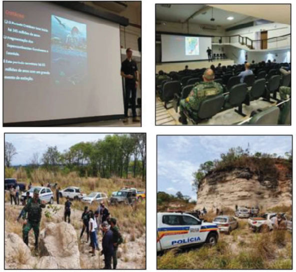
Source: Geopark Uberaba Project Team
The prosecutor Carlos Valera, from the Regional Coordination of Environment of MPMG, was present at this course and highlighted the importance of municipal and military environmental inspectors in preserving the fossils buried in the municipality's soil (FISCAIS..., 2021). Geologist Ribeiro emphasized: 'The course is preparing the personnel of the Municipal Government of Uberaba and the environmental military who work in rural areas to take correct and assertive actions (FISCAIS..., 2021).' Thus, the team of the Geopark Uberaba Project has made progress in both heritage and geological education and, most importantly, in geopreservation, the two pillars of the Project.
Legislation (National and Municipal) related to geopreservation: Considering the above, we observe that public policy actions aimed at geopreservation laws guarantee the proper compliance of man with environmental rules. In Brazil, there is Decree Law no. 4,146 of March 1942, which regulates the protection of fossil deposits and provides that these are properties of the nation (BRASIL, 1942). In addition, this Decree also regulates the need for prior authorization from the National Mining Agency regarding fossil extraction (BRASIL, 1942). Thus, there is a federal norm that protects geological heritage. In Uberaba, in 2015, while a condominium was being built in the Vila Olímpica neighborhood, next to the Praça Shopping, two dinosaur fossil skeletons were found. At that time, the CCCP team contacted the National Mineral Agency, the prosecutor of the Public Prosecutor's Office of the State of Minas Gerais - Dr. Carlos Alberto Valera - and the secretary of the Municipal Environment. Together, they prepared a text, each with their respective expertise on the subject, to be sent to the Uberaba City Hall for it to promulgate the Decree. Thus, on July 17, 2015, the Uberaba Municipal Government promulgated Portaria no.003, which establishes procedures for excavating, moving soil, or any other interference that may damage fossil reserves in the city's territory (UBERABA adota..., 2015). This action aligns with the definition of geopreservation and provides the municipality with laws that protect the city's geological heritage, an excellent model to be used in other metropolises and/or in other geoparks. Therefore, any work in the municipality of Uberaba that interferes with or damages rocks from the Uberaba, Vale do Rio do Peixe, and Marília formations must, necessarily, have the accompaniment of a specialized technician, as there is a great possibility of finding a fossil (PORTARIA..., 2015). According to the mentioned decree, the person responsible for the work must have the authorization of a specialized technical responsible, who must be a paleontologist or a geologist, who must have proven experience in paleontological monitoring and rescue programs (UBERABA, 2015).
Access the decree here:
https://drive.google.com/drive/u/1/folders/1yFdXvk4IxTrB8MuooyDLTfL-TXvQvo39
Paleontological Zoning in the Municipality of Uberaba
The Special Fund of the Public Prosecutor's Office of the State of Minas Gerais (FUNEMP) will provide resources for the paleontological zoning of the city, identifying fossil and paleontological sites in the city's soil (UBERABA..., 2020).
The resources will be R$ 100,000 from the law granting tax incentives for economic development, provided by the Municipality, and R$ 100,000 from the State and Federal Public Prosecutor's Office, from the environmental Adjustment of Conduct Terms (TACs) (UBERABA..., 2020).
'The challenge now is to improve enforcement,' said prosecutor Carlos Valera, revealing that Uberaba will have its geological zoning. According to the prosecutor: 'Paleontology is in Uberaba's DNA, highlighting the importance of the Geopark Project to leverage the city's tourism potential' (FISCAIS..., 2021).
According to the mayor at the time, Paulo Piau, the action constitutes a guiding instrument for the preservation of biodiversity, without hindering economic development, i.e., an environmental and economic gain for the city of Uberaba (UBERABA..., 2020).
In the view of prosecutor Carlos Valera, by carrying out the mapping, we will know exactly where the fossil points will be. Therefore, it will be easier and faster, as the material is identified and removed before the work takes place.
The deputy secretary of Economic Development, Tourism, and Innovation at the time, Anne Roy Nóbrega, considered this action a legal and extremely important milestone for geoconservation actions, a crucial point for the Geopark Uberaba Project's endorsement.
According to Nóbrega, the preservation of Uberaba's geological heritage is likely to be an international highlight. 'One of the most important actions is that the community can actually adopt this environmental preservation project with economic development,' which are two quite conflicting aspects to achieve in consensus.
Nóbrega also emphasized that the paleontological mapping will be defined by three colors (green, orange, and red), with green: areas where there are no indications of paleontological material; orange, areas that may eventually have this material; red, soils that possibly, because they are predominantly fossil-bearing rocks, have paleontological material. In the red areas, when the materials are found, they will be removed and delivered to UFTM for cataloging and identification (UBERABA..., 2020).

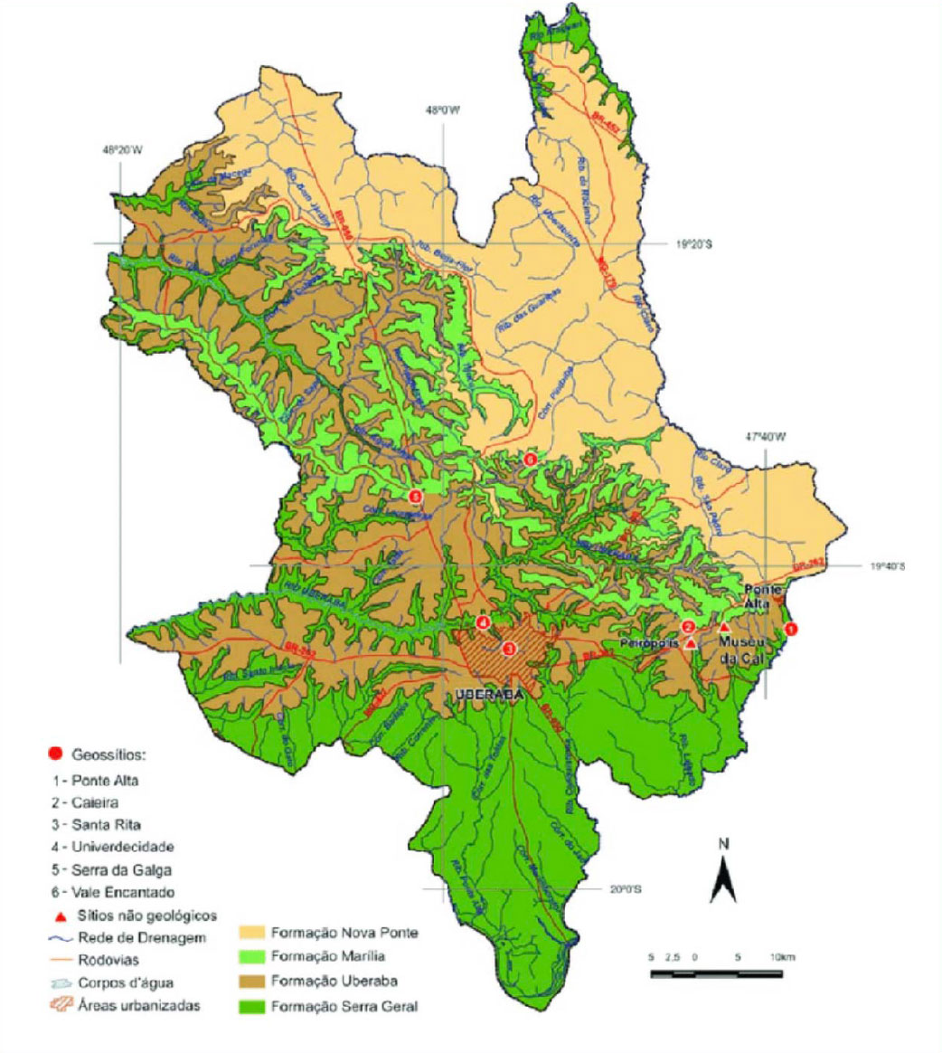
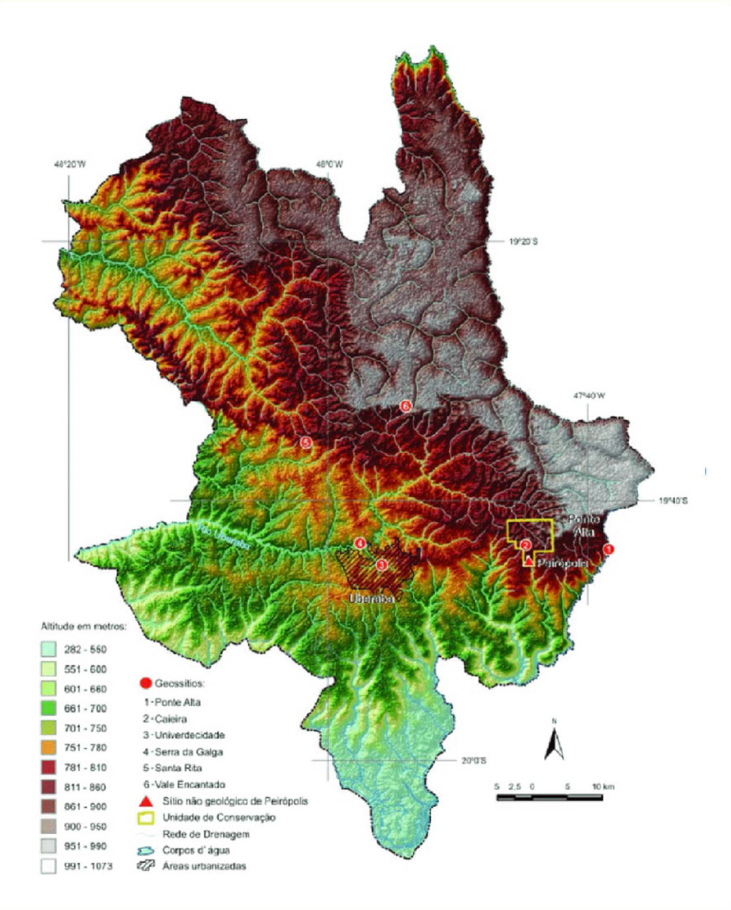
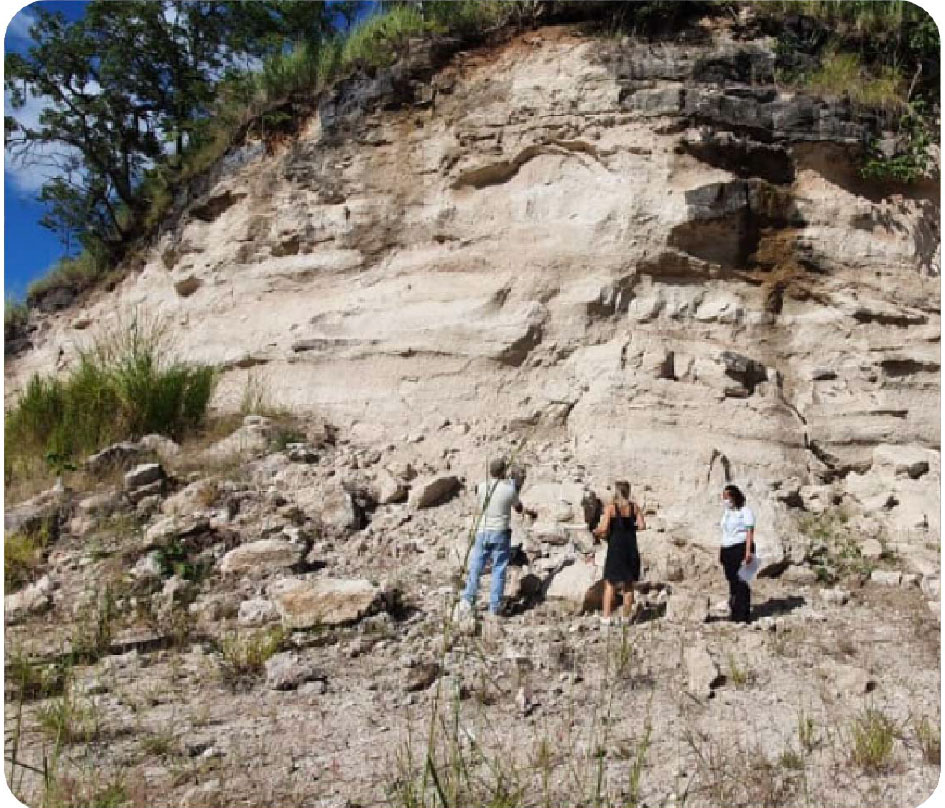
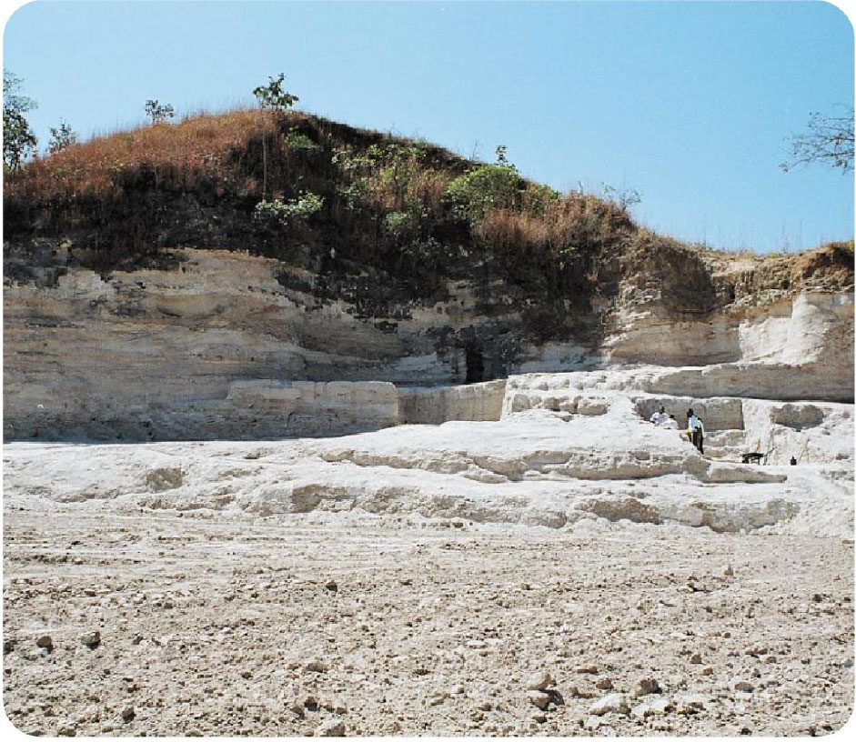
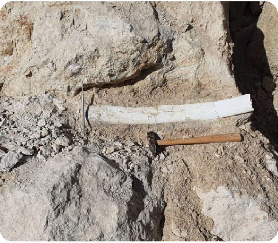
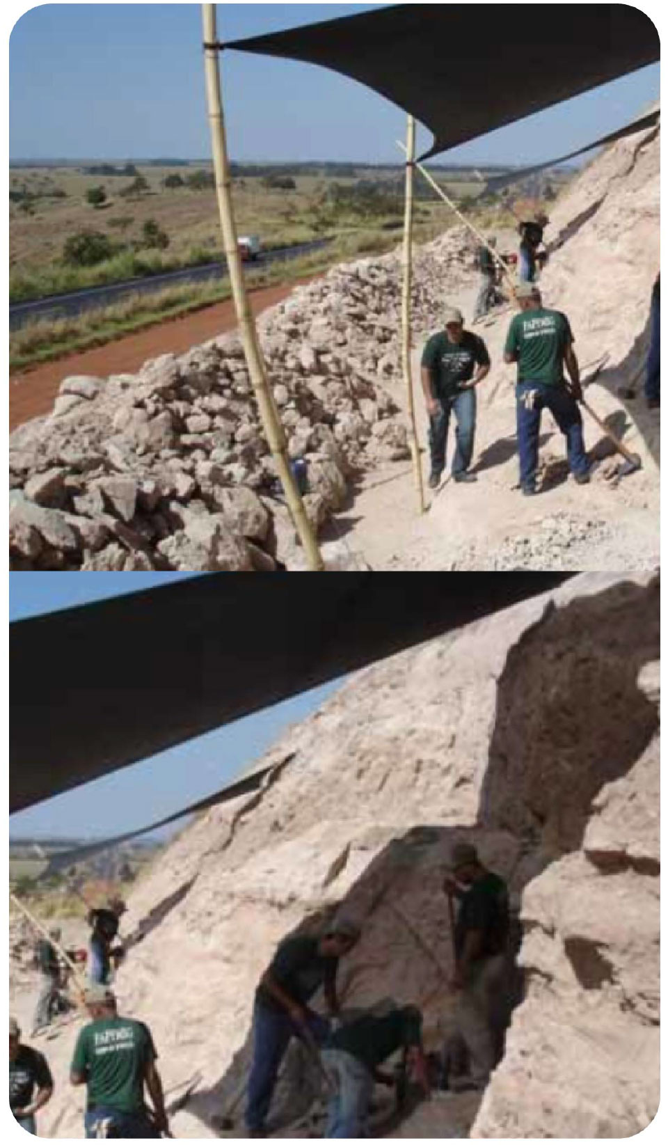
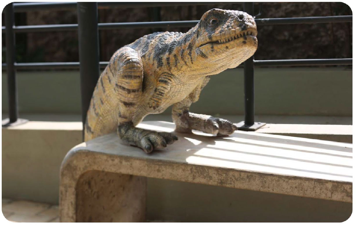
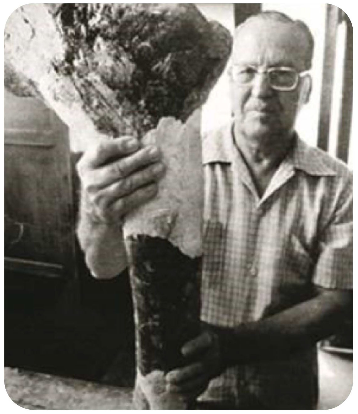 Figure: Llewellyn Ivor Price with a dinosaur fossil found in the Mangabeira region.
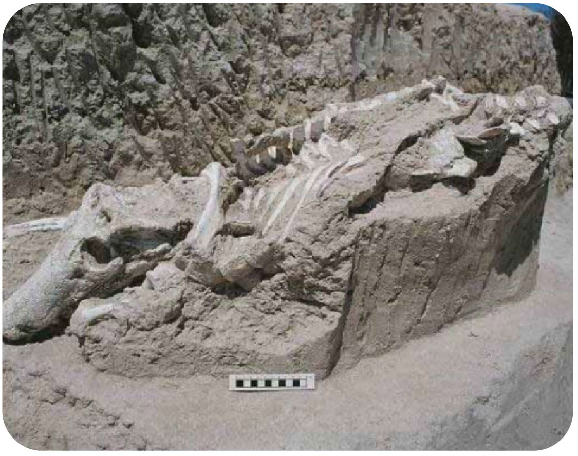 Figure: Fossil of Uberabasuchus terrificus during excavations in September 2000.
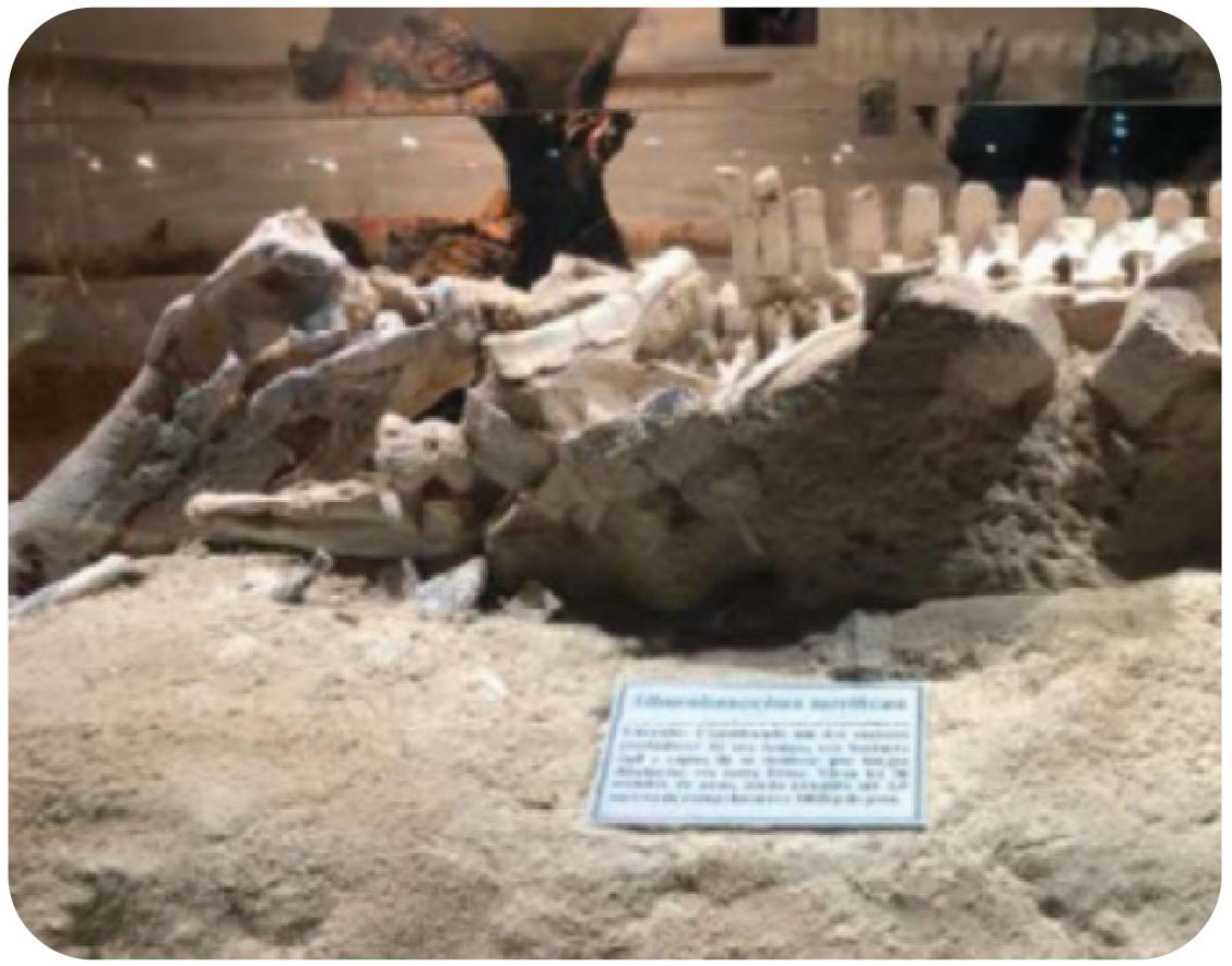 Figure: Fossil of Uberabasuchus terrificus at the Museum of Dinosaurs.
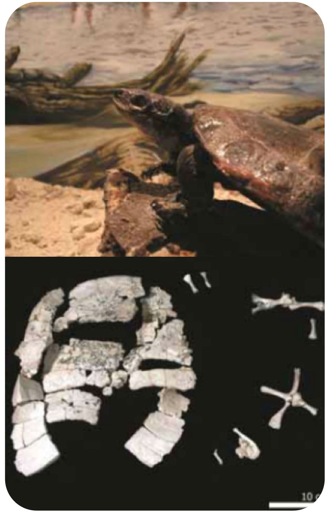 Figure - Life and fossil reconstruction of Cambaremys langertoni. Sculpture by Ariel Milani Martine.
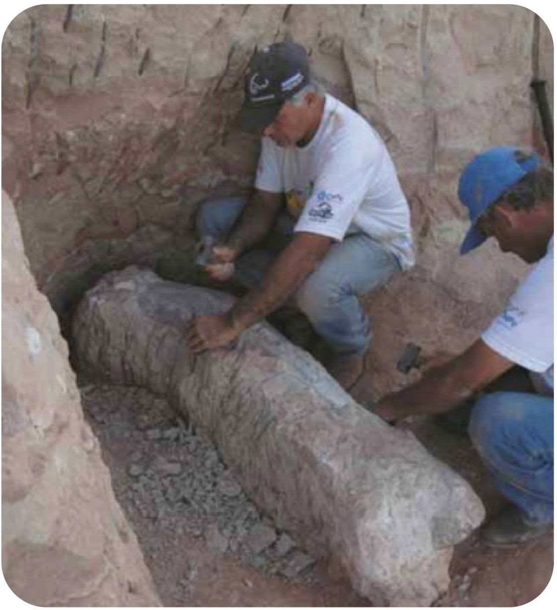 Figure - Excavations of Uberabatitan ribeiroi at km 153 of BR 050 Highway, Serra da Galga Geosite.
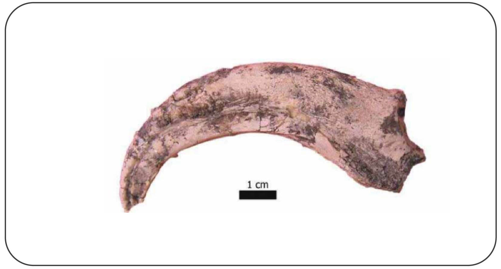 Figure - Fossil claw of Maniraptora from Peirópolis.
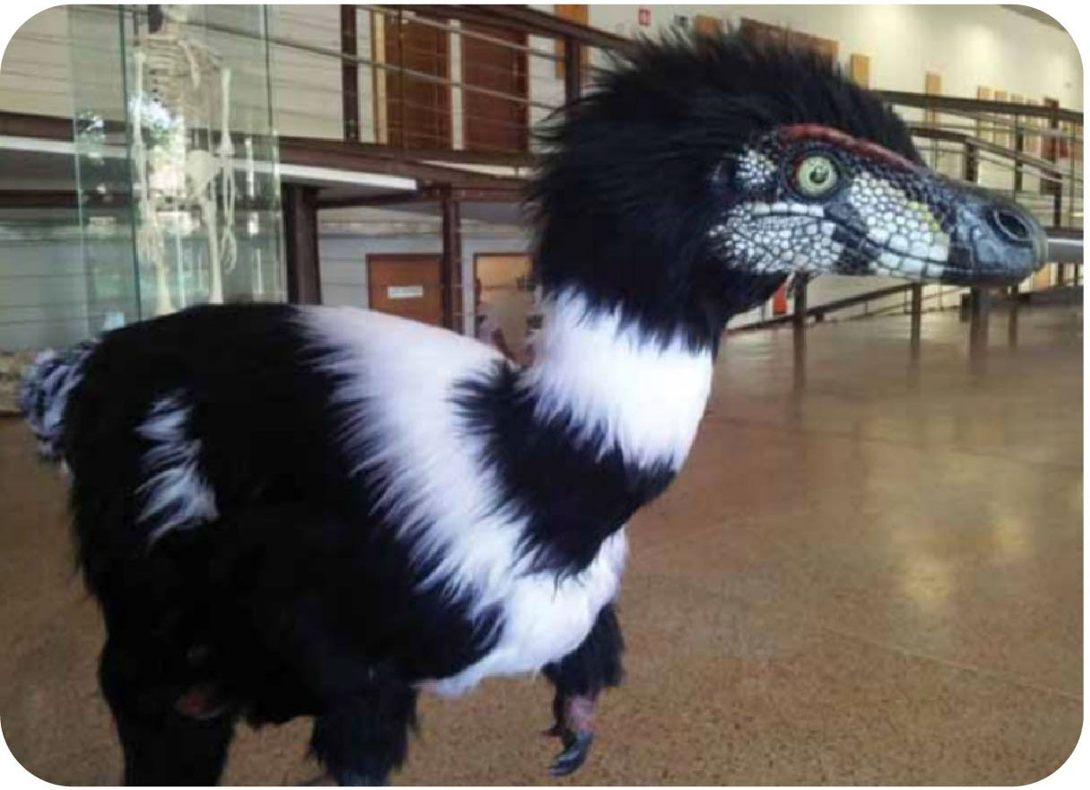 Figure - Life reconstruction of the Peirópolis Maniraptora. Sculpture: Rodolfo Nogueira.
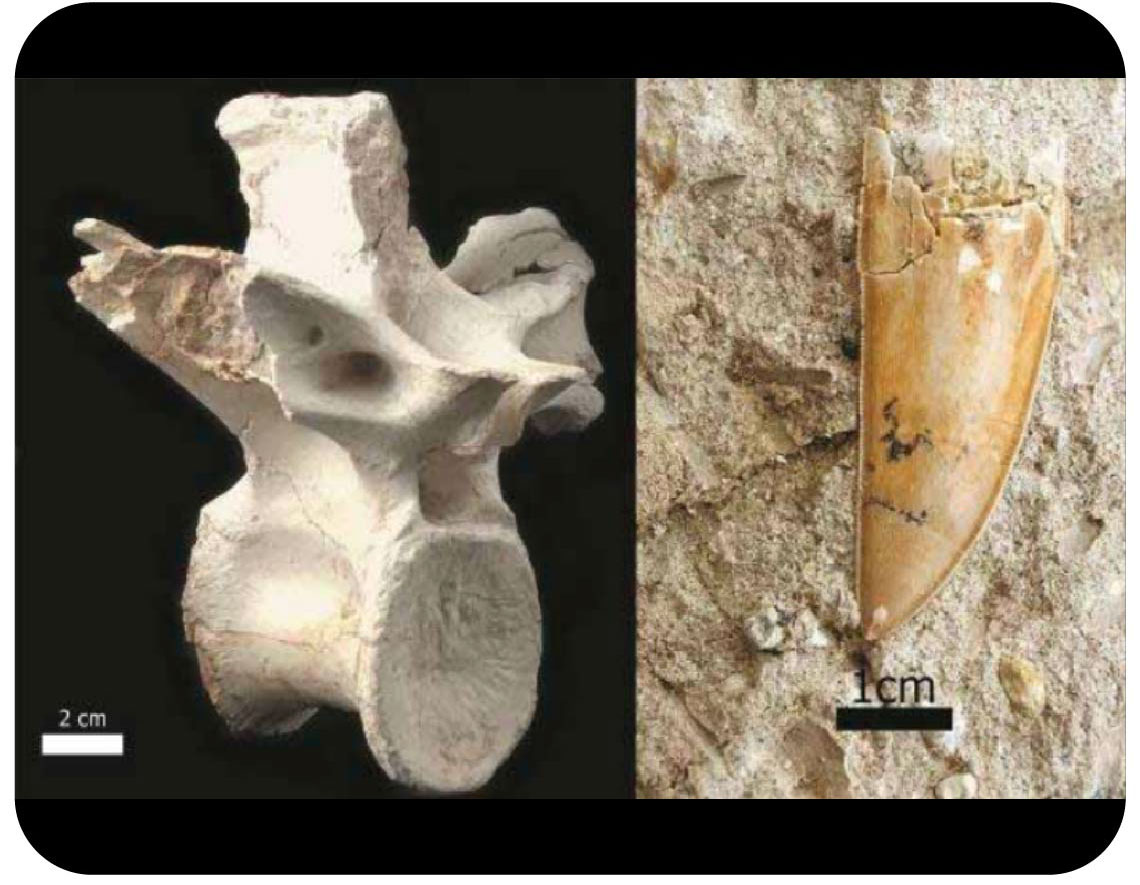 Figure - Excavations of Uberabatitan ribeiroi at kilometer 153 of BR 050Geossítio Serra da Galga.
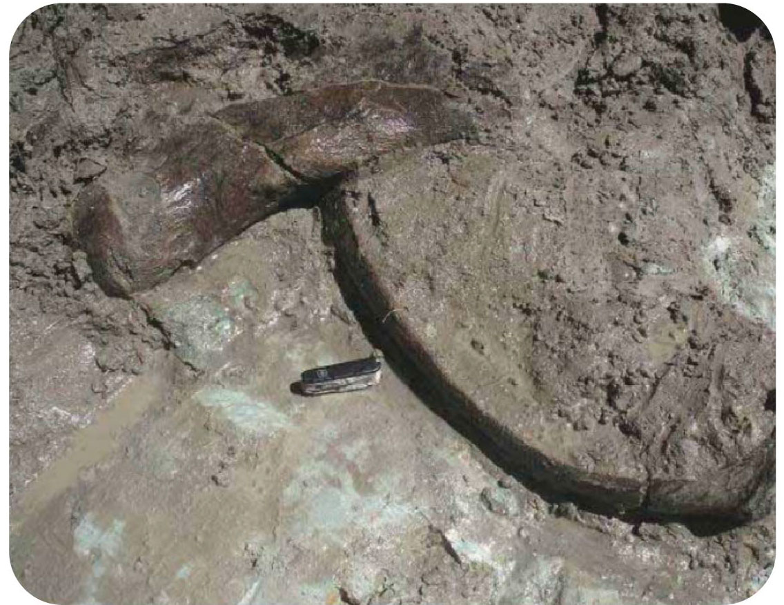 Figure - Fossil excavations of Eremotherium laurillardi in the city of Uberaba in 2006.
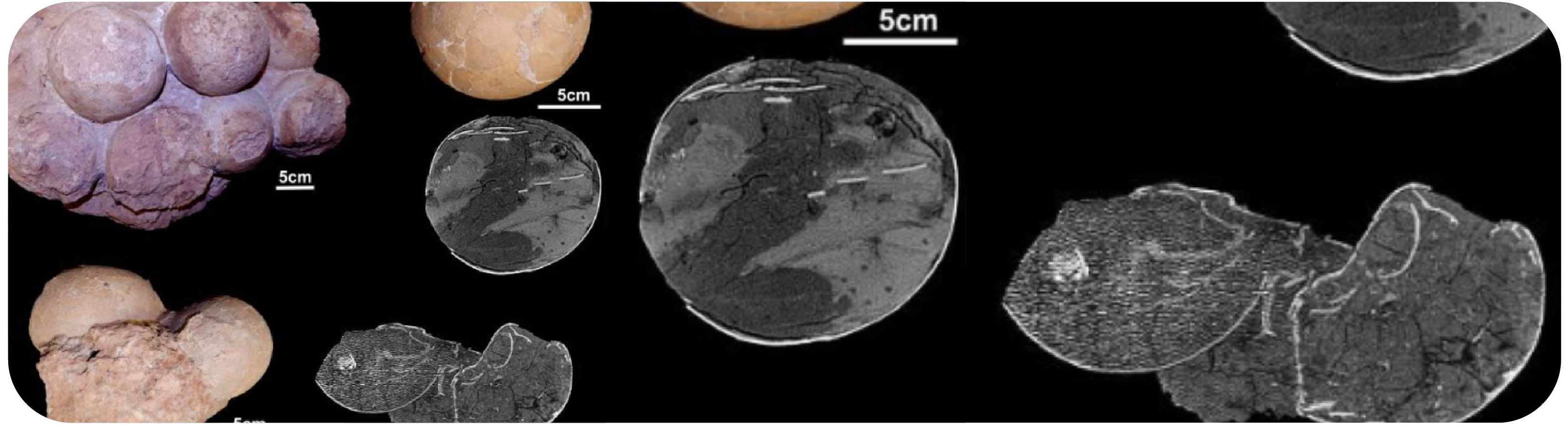 Photo Release: Some eggs from the discovery in Ponte Alta.
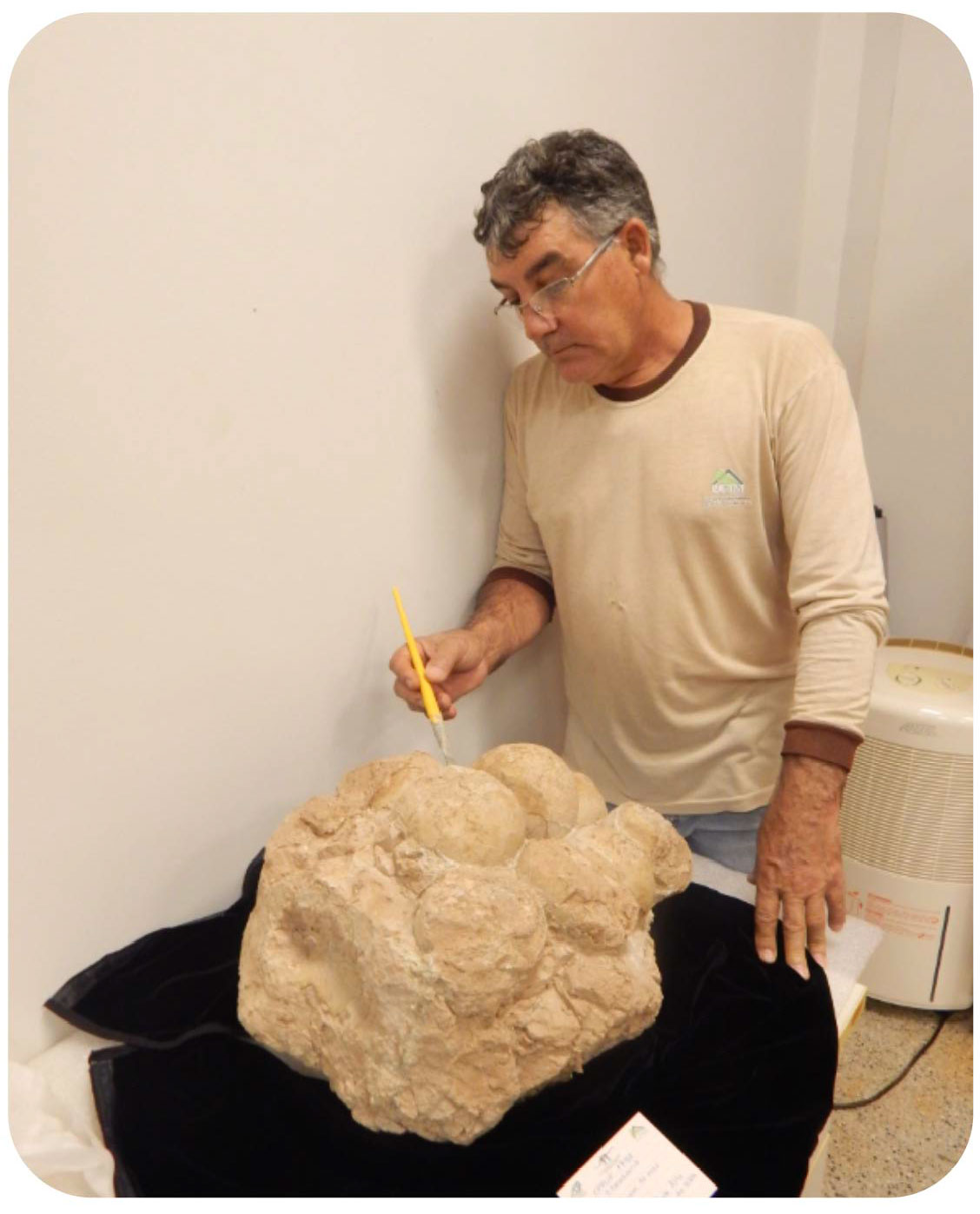 Photo Release: João Ismael, from the Cultural Foundation of Uberaba/Municipal Government of Uberaba, preparing a clutch.


 Versão Português